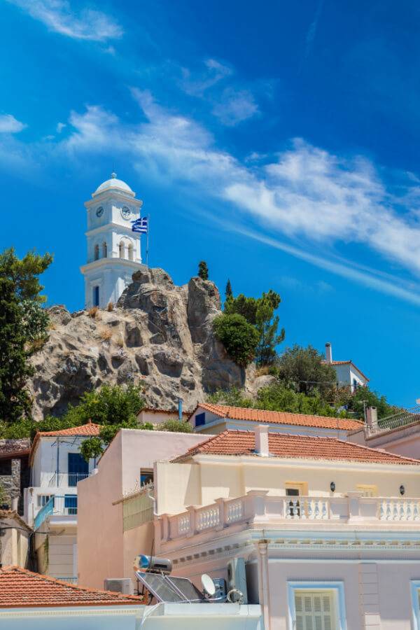
Poros
Population: 3,993 (2011)
ISLAND OVERVIEW
Poros is a small Greek island-pair in the southern part of the Saronic Gulf, about 58km south from Athen’s port of Piraeus. Poros consists of two islands: Sphairia in the southern part, which is of volcanic origin, where today’s city is located, and Kalaureia (meaning ‘gentle breeze’), the northern and largest part. A bridge connects the two islands over a narrow strait. The highest peak is Vigla (358 m) in the west-central part. Sandy beaches are restricted to the island’s southern shore, except for a bay in the northern part called Vayionia.
Poros is an island with rich vegetation. Much of the northern and far eastern/western sides of the island are bushy, whereas large areas of old pine forest are found in the South and centre of the island. It is a popular resort for short holidays and there are many sights to see; including the ruined temple of Poseidon from the 6th century BC and the monastery ‘Zoodochos Pigis’ (meaning ‘life-giving source’).
The picturesque town of Poros is built on a hillside and as you approach Poros port by ferry the trademark Poros Clock Tower, stands out to greet you.
Poros is easily accessible from Athens via ferry or hydrofoil and one can reach the island by car or bus from the mainland at Galatas.

The Island & Its History
click image to view in Google Maps
The word Poros means a strip of sea, narrower than a strait, uniting two little bays. During ancient times, according to the author Pausanias, you could walk across it!
In the North-Eastern part of the island, archaeologists discovered the ruins of a settlement from the Early Bronze Period which is believed to be interrelated with the wreck found on the nearby Dokos island.
In 1484 the Venetians occupied Poros and used it as a strategic port in their sea battles. Poros was the most powerful city in the region, and during that time the island had about 15,000 inhabitants, making it one of the largest cities in Greece.
Poros had an important role during the Greek Revolution in 1821, due to its strategic position.
In September 1828, the ambassadors of England, France and Russia met in Poros with Ioannis Kapodistrias in order to determine the borders of the future Greek state, which was established two years later, in 1830.
With the Treaty of Kuchuk Kainarji, Russia secured free shipping for its navy. As Russian naval activity grew, land was acquired at the edge of Poros town. Extensive material, coal, and food storage facilities were built, as well as a hardtack baking factory.
After Greek independence, Governor Capodistrias requisitioned the facilities for use of the Greek Navy, and offered the Russians an alternative location in a nearby cove. The new facilities were far more extensive and were used by Russian ships throughout the 19th century. The number of Russian residents of Poros increased and a Russian school was even established. Then as Russian naval activity declined, so did the base and by the early 20th century only a single Russian watchman was left guarding it. It was then granted to the Greek navy by the Czar but was never commissioned, and the abandoned buildings were left to decay. The ruins, in elaborately carved stone, were listed as protected architectural monuments in 1989.
Prayer Points
- The people on the island will realize their need for God and their eyes will be opened to the truth and love of God through reading the Bible for themselves.
- The Lord will work in the lives of all the God-fearing religious people already living on this island, and bring healing & refreshment to their lives.
ADOPT THIS ISLAND
If you are committed to praying for this island and its region, please drop us a note, we would love to know about it and keep you posted with prayer updates!
By completing this form, I consent to receive content from Broad Reach Maritime in accordance with our Privacy Policy.

